Scientists

The other day a group of scientists from Canada published the results of work on the study of a large river in the circumpolar region of Canada. Experts believe that they faced the first case of a change in the direction of the flow of a large river due to anthropogenic climate change. This is not about human activities in general, because in their history, various states have changed currents or completely drained a variety of rivers and larger bodies of water (let us recall the Aral Sea). Now we are talking about a specific manifestation of climate change in the form of melting glaciers.
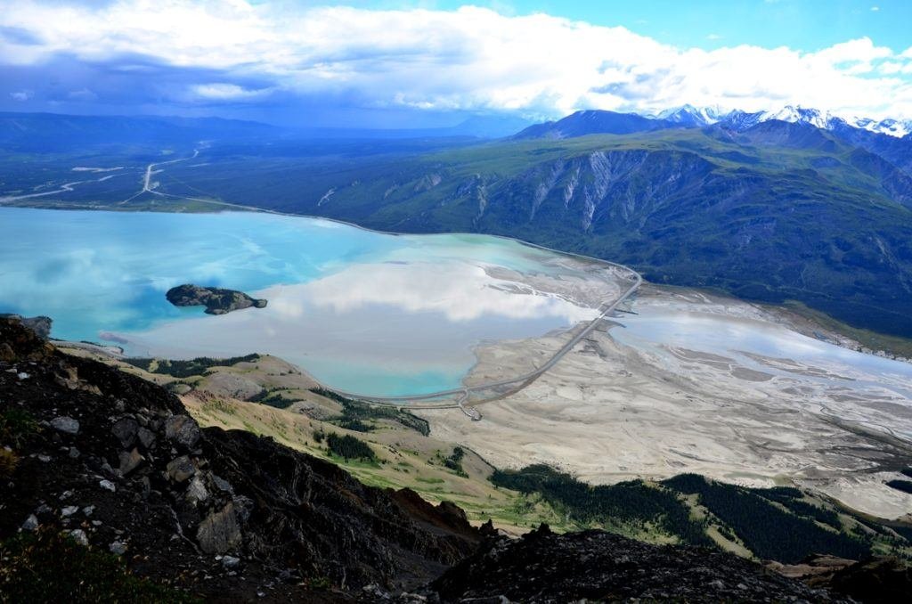
In mid-2016, Canadian scientists realized that in one of the regions of the Yukon, owned by Canada, the water from the glacier began to flow from one river system to another. Because of this, the river, which had previously flowed into the largest lake of the Yukon Cluin, became shallow, and the bulk of the glacier meltwater is now flowing down the channel of another river to the Pacific Ocean in southern Alaska.
Researchers argue that such changes occurred for the first time in the history of mankind. Of course, earlier the rivers changed channels and directions of the current, but the reasons were natural, for the most part they were geological. Now the anthropogenic influence becomes more and more noticeable.
“The river was not in the place where we were just a few years ago. That is, the river has remained, but it is only a pale shadow of what it was, “said the head of the research group Daniel Sugar from Washington University in Tacoma. He says that the current of the river has changed due to the fact that the glacier feeding it has changed: “In fact, every day we see how the water level falls, we see the emerging shoals.”
The results of the research were published in an authoritative scientific publication Nature Geoscience. Scientists from six Canadian and American universities took part in the work.
According to scientists, the level of Lake Cluain also began to fall, and very noticeably. Of course, this was to be expected, since the disappeared river was one of the largest water “arteries” that fed the lake. But the pace of shallowing surprised specialists. The lowest water level in Clouyne was recorded in August. People living in this region, now forced to follow the water, leaving the usual places. So far, this applies to only two small communities, but this is only the beginning.
“The water level in Cluain has already fallen and continues to fall. If the dynamics persists, the lake will turn into a closed reservoir, which will change the chemistry of the water, the structure of the lake itself and the biological component, “the researchers reported in their article.
Changes did not happen suddenly. As early as last year, the waters of the receding glacier broke through the ice barrier, as a result, a glacial lake emerged that had previously fed the Slims River, which is in question. The mass of water broke into the system of another river, leaving a noticeable canal along which the water began to move away. Previously, all these waters flowed into the huge Yukon River.

The figure shows a new channel that opened the way to the water in another region. Because of this, the waters that previously fed the Slims River went into a different river system.
Scientists believe that there is only one reason that the water has left – the gradual climate change that led to the melting of glaciers. This process began in 1956 and continues to this day.
The second river, where water began to get from the glacier, is called Alsek. It flows into the Gulf of Alaska, where a large amount of fresh river water is now being recorded.
As mentioned above, all these changes have not yet affected people, which are very few in the region. But if the same situation occurred in another, more densely populated area, then the changes could change people’s lives and very much. Such changes can be observed elsewhere on Earth. For example, in the Bolivian Andes, where people living in lowlands are exposed to the danger of being flooded with glacial waters, breaking through from above. The cause is the same – warming.

The Kaskolsh Glacier is close to the Arctic Circle, so it can be called indicative in terms of the ability to track climate change. Its total area is 25,000 kilometers. Now scientists are actively monitoring the region, trying to predict further changes.
As far as the Slims River is concerned, it is believed that experts will not completely disappear. Rather, it will move into a new state of equilibrium and will continue to exist. “This is an interesting study that confirms climate change and gives an understanding of the scale of what is happening,” says glaciologist Richard Ellie of the University of Pennsylvania.


